dilluns, 28 de setembre del 2015

HÈLSINKI

Very soon... a new video of our stay in Helsinki last summer! _Ben aviat... un vídeo d'Hèlsinki del nostre viatge de l'estiu passat.


Nauttikaa! Enjoy_gaudiu!
MOI, MOI!

divendres, 18 de setembre del 2015

HÈLSINKI

Our last stop in Finnish Lapland_ Äkäslompolo, route E8 to Tornio (before driving back to Rovaniemi). The part of the E8 we drove (except when we leave it in Muonio to go to Äkäslompolo) runs from Tromso (Norway), passing through the border with Norway in Kilpisjärvi (Finland) always along the border with Sweden, which is almost all the beside the river Muonionjöki until Tornio (where it joins the E75 to Helsinki). _Última etapa a la Lapònia finlandesa_ Äkäslompolo i la E8 fins a Tornio (abans de tornar a Rovaniemi). El tros de E8 que vam agafar (excepte quan ens vam desviar a Muonio per anar cap a Äkäslompolo) discorre des de Tromso (Noruega), passa per la frontera amb Noruega, a Kilpisjärvi (Finlàndia), sempre al costat de la frontera amb Suècia, divisant, pràcticament tota l'estona, el riu Muonionjöki, fins a Tornio (on enllaça amb la E75 fins a Hèlsinki).
 

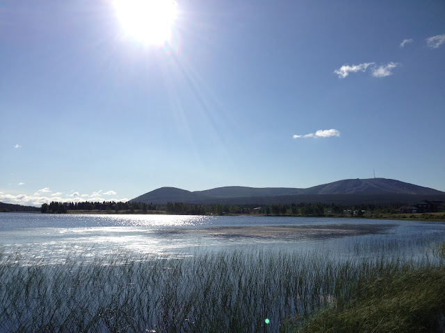
Äkäslompolo is a village in the municipality of Kolari in Lapland. It had 437 inhabitants at the end of 2011. Äkäslompolo is located around the lake of the same name in the Pallas-Yllästunturi National Park (the third largest in Finland). _Äkäslompolo és un poble de la municipalitat de Kolari, a la Lapònia. Tenia 437 habitants a finals de 2011. Äkäslompolo es troba al voltant del llac del mateix nom, dins del Parc Nacional Pallas-Yllästunturi (el tercer més gran de Finlàndia).


The blue building that you see in these images is the church of Äkäslompolo, which contrasts with the traditional red painted wood architecture. _L'edifici blau que veieu en una d'aquestes imatges, és l'església d'Äkäslompolo, que contrasta amb l'arquitectura més tradicional de fusta vermella.

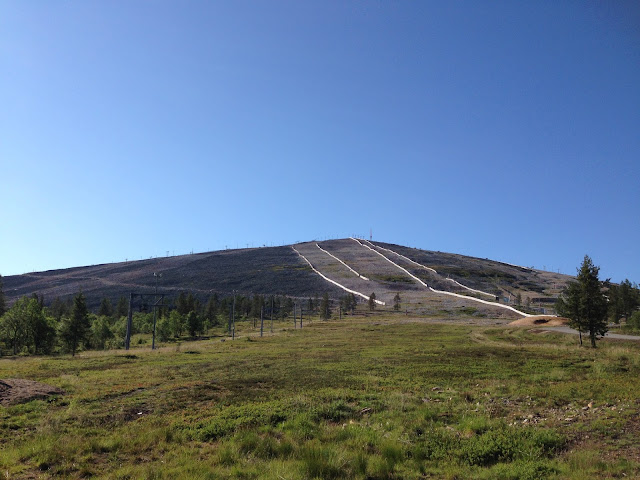
Its main source of income is tourism in Ylläs, ski area (which it shares with the neighboring town of Ylläsjärvi) during the winter season and, more recently, Ylläs Soikoon music festival, which attracts a new tourism in the summer. _La seva principal fonts d'ingressos és el turisme a Ylläs, les pistes d'esquí (que comparteix amb la població veïna d'Ylläsjärvi) durant la temporada d'hivern i, més recentment, el festival de música Ylläs Soikoon, que atrau, juntament amb l'excursionisme, un nou turisme a l'estiu.


Äkäslompolo is also known as "the town of the seven hills": Yllästunturi, Kuertunturi, Kukastunturi, Pyhätunturi, Kesänki, Lainiotunturi and Kellostapuli. The Ylläs ski area has a total of 330 km of cross-country ski tracks, and 61 Alpine ski slopes with 29 ski lifts.   Yllästunturi has two ski centers: Äkäslompolo Ylläs-Ski and Sport Resort Ylläs. Together they form the largest ski area in Finland. In addition, there are around 410 km of routes for snowmobiles. _Äkäslompolo és també conegut com "el poble dels set turons": Yllästunturi, Kuertunturi, Kukastunturi, Pyhätunturi, Kesänki, Lainiotunturi ja Kellostapuli. Aquí hi discorre la xarxa més extensa de senders de Finlàndia, que compta amb un total de 330 quilòmetres de pistes d'esquí de fons, dels quals 38 quilòmetres s'il·luminen, i 61 pistes d'esquí alpí amb 29 remuntadors. Yllästunturi són dos centres d'esquí: Äkäslompolo Ylläs-esquí i Sport Resort Ylläs. Junts formen la zona més gran d'esquí de Finlàndia. A més, al voltant hi ha uns 410 km de pistes per a motos de neu.


In summer Äkäslompolo is popular among hikers, anglers, canoeists, and other outdoor enthusiasts. Buildings are widely dispersed from each other, what frees the nature of the stress from overcrowding. _A l'estiu, com dèiem, Äkäslompolo és popular entre els excursionistes, pescadors, piragüistes i altres amants de l'aire lliure. Les edificacions estan molt disperses les unes de les altres, això allibera la natura de la tensió de la massificació.


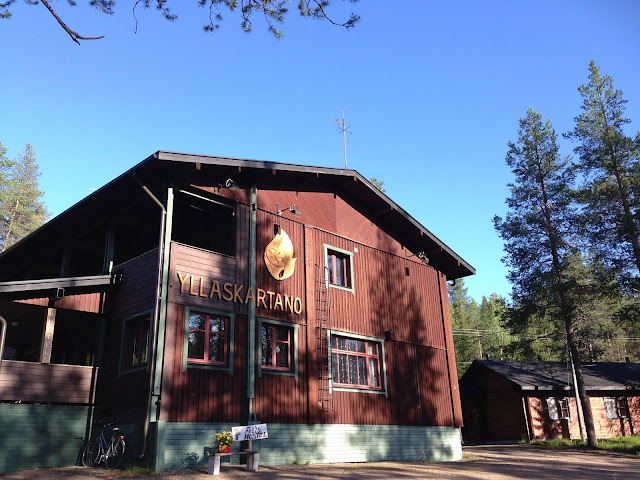
There are several hotels and many holiday homes and cabins (mökki) in the area. For example, the Seven Fells Hostel, where we stayed there one night. Apart from the rooms of the main building, if you have the opportunity to stay in one of their cabins, you will surely live a "lodge" experience surrounded by a summer green and vibrant nature, and the show of the snow and northern lights in winter. _Hi ha diversos establiments per a l'allotjament i moltes cabanes (mökki) en lloguer a la zona. Com per exemple, el Seven Fells Hostel, en el que ens hi vam allotjar una nit. A part de les habitacions de l'edifici principal, si teniu la possibilitat d'allotjar-vos en alguna de les seves cabanes, viureu, de en segur, una experiència lodge envoltat de natura verda i vibrant a l'estiu, i de l'espectacle de la neu i les aurores boreals a l'hivern.


Surely you'll see reindeers and squirrels from your window! _De ben segur que, en qualsevol moment, podreu veure rens o esquirols des de la vostra finestra!


Next day we continued the route... to Tornio, on the border with Sweden, before driving back to Rovaniemi. _L'endemà vam continuar la ruta... fins a Tornio, a la frontera amb Suècia, abans de recular cap a Rovaniemi. 


The city was founded on the island of Suensaari (1621). The name of Tornio is an old Finnish word meaning spear: the city is named for the river Tornio. During the eighteenth century was visited by several expeditions going to the Arctic. The most notable was that of a member of the Académie Française, Pierre Louis Maupertuis, who was measuring the meridian arc. The top of the church of Tornio was one of the points used for Maupertuis in his measurements. This church was built in 1686 by Matti Härmä Joosepinpoika. Tornio church is one of oldest and most well-preserved wooden churches in the Northern Finland and Scandinavia. _La ciutat va ser fundada a l'illa de Suensaari (1621). El nom de Tornio és una paraula de l'antic finès i significa llança de guerra: la ciutat rep aquest nom pel riu Tornio. Durant el segle XVIII va ser visitada per diverses expedicions cap l'Àrtic. La més notable va ser la d'un membre de l'Académie Française, Pierre Louis Moreau de Maupertuis, qui hi va mesurar l'arc de meridià. La part de dalt de l'església de Tornio va ser un dels punts usats per de Maupertuis en els seus mesuraments. Aquesta església va ser construïda el 1686 per Matti Joosepinpoika Härmä. L'església de Tornio és una de les esglésies de fusta més antigues i ben conservades al nord de Finlàndia, i de tots els països nòrdics.


Until the late nineteenth century, the inhabitants of nearby spoke Finnish and Sami Kemi, while the city itself dominated the Swedish language. After World War II was installed at Tornio popular brewery Lapin Kulta ('the gold of Lapland'). A large shopping center is the new frontier, and from Finland, an IKEA awaits on the other side. _Fins al final del segle XIX, els habitants dels voltants parlaven finès i sami de Kemi, mentre que a la ciutat mateixa predominava l'idioma suec. Després de la Segona Guerra Mundial a Tornio s'hi va instal·lar la popular fàbrica de cerveses Lapin Kulta (literalment: l'or de Lapònia). Un gran centre comercial n'és la nova frontera i, des de Finlàndia, un IKEA t'espera a l'altra banda.


Tornio and Haparanda (the Swedish zone) are twin cities, and historically there is a project to merge under the name TornioHaparanda and HaparandaTornio. _Tornio i Haparanda (la part sueca) són històricament ciutats bessones i hi ha el projecte de fusionar-se sota el nom de TornioHaparanda i HaparandaTornio.


Nauttikaa! Enjoy_gaudiu!
MOI, MOI! Ja ihanaa viikonloppua!

dimecres, 16 de setembre del 2015

A CASA NOSTRA hi ha...

Hyvää keskiviikkoa (wednesday_dimecres) kaikille!
Just a little break from Finland adventures to introduce you this two that came home to celebrate our birthdays to stay with us and with their other friends... Fem una petita pausa les aventures a finlandeses del blog per presentar-vos aquest parell que han vingut a casa per a celebrar els nostres aniversaris, per estar amb nosaltres i amb els seus nous amics.

 
We're proud to present you Alexander's Girard Wooden Dolls number 21 and number 22! És un plaer per a nosaltres presentar-vos a les Wooden Dolls, d'Alexander Girard, número 21 i número 22!

 
Nauttikaa! Enjoy_gaudiu!
MOI, MOI!

dimarts, 15 de setembre del 2015

HÈLSINKI

Three-country cairn (Kilpisjärvi). 08-07-2015 _Kolmen valtakunnan rajapyykki 07_08_2015

Three-Country Cairn. (Treriksröset (in Swedish), Treriksrøysa (in Norwegian), Kolmen valtakunnan rajapyykki (in Finnish)) is the point at which the international borders of Sweden, Norway and Finland meet. It is an example of a geographical feature known as a tripoint. The name can be translated into English as "Three-Country Cairn", and is named for the monument of stones erected in 1897 by the governments of Norway and Russia (which was administering Finland at the time). The Swedish could not agree on a boundary commission with the Norwegians and did not contribute their stone until 1901. This is Sweden's most northerly point and it is the westernmost point of the Finnish mainland. The tripoint monument itself is a beige conical frustum made of concrete, located about 10 metres out in Lake Goldajärvi (also known as lake Koltajauri). It is located at 489 metres above sea level. The monument was built in 1926. As an artificial island, it is sometimes mentioned as the world's smallest island divided by a border. _Treriksröset (en suec), Treriksrøysa (noruec), Kolmen Valtakunnan Rajapyykki (finès) és el punt en què es creuen les fronteres de Suècia, Noruega i Finlàndia. El trifinio es troba aproximadament a 69 ° 03'30 "N 20 ° 33'0" E. El nom significa, aproximadament, "Monticle de les tres nacions", i es coneix com a tal pel monticle de pedres erigit en el lloc en 1897 per Noruega i Rússia, que administrava Finlàndia en aquell moment. Els governs suec i noruec no es van posar d'acord per establir una comissió bilateral de demarcació de les fronteres, de manera que fins a 1901 Suècia no va contribuir al monument. És el punt més septentrional de Suècia, i també el lloc més occidental de la Finlàndia continental. El monument actual, que va ser construït el 1926, és una pedra troncocònica feta de formigó, situada a uns deu metres de la riba del llac Goldajärvi.

While we were preparing our summer trip to Finland, we decided that the main target should be to go to the Three-Border Cairn... between three Nordic countries: Sweden, Norway and Finland. _Quan dissenyàvem aquest darrer viatge a Finlàndia, vam decidir que l'objectiu principal a realitzar havia de ser el punt que marca la frontera entre tres països nòrdics... Suècia, Noruega i Finlàndia. 


This place, which is called Kolmen Valtakunnan Rajapyykki in Finnish, is about 11km walk from the parking and the information point (a few kilometers from the center of Kilpisjärvi). It had been raining all morning and that made us think that maybe we should withdraw and not begin any hike. Not because a little water scared us, but ,it must be said, we are not usual hikers. After lunch, the weather improved. At first a fine rain may accompany us all the way, but then, even though it didn't appear the sun rain stopped and we could remove our waterproof capes. Not pullover or cap. It was cold, but it wasn't either hot. In addition, we needed to cover us to protect us from thousands of mosquitoes. We made us brave and did not had with us any... chemical protection... against these little vampires. _Aquest punt, que en finès s'anomena kolmen valtakunnan rajapyykki, es troba a uns 11km a peu de l'aparcament de l'inici del recorregut (a pocs quilòmetres del centre de Kilpisjärvi). Havia estat plovent tot el matí, i això ens feia pensar que potser hauríem de desistir, i tornar amb la cua entre cames sense haver pogut ni començar l'excursió. No és que ens espanti una mica d'aigua, però, tot s'ha de dir, no som excursionistes. Però després de dinar, el temps semblava que millorava i ho vam aprofitar. En un primer moment una fina pluja ens acompanyaria potser tot el trajecte, però de seguida, tot i que encara no apareixia el sol, va parar i ens vam poder treure la capelina. No el jersei ni el gorro. No feia fred, però tampoc feia calor. A més, necessitàvem tapar-nos tan com pugéssim per a protegir-nos dels milers i milers de mosquits que ens perseguien: Vam fer-nos els valents (tampoc crèim que pugués ser tant) i no vam dur cap tipus de protecció... química... contra aquests petits vampirs.


Once we reached the highest point of the road, about to cross a quarry, the afternoon light changed and a light sunny light appeare. The path is not complicated, but as we said before, we are not regular hikers... It is not difficult and is well signposted. But the rain of recent days had left this little path sometimes slippery. _Un cop arribar al punt més alt del camí, a punt de creuar una pedrera, la llum de la tarda va canviar i va deixar entreveure que el sol acabaria fent acte de presència. El camí no és complicat, però, com hem dit abans, no som excursionistes... habituals. No és difícil i està molt ben senyalitzat. Però la pluja dels darrers dies havia deixat el camí(...net) força moll, i a vegades relliscós.


Mosquitoes gave no truce and this was quite frustrating because, under no circumstances could anyone think about stopping to rest a single instant. We could have been devoured  alive! The experience, however, is highly recommended... the place and destination of this hiking trail, after walking nearly four hours, is truly a reward for any effort. _Els mosquits no donaven treva, i això era força frustrant perquè, sota cap concepte, podies pensar en parar a descansar ni un sol instant. Se'ns haguessin cruspit de viu en viu! L'experiència, però, és altament recomanable... i el punt destí de l'excursió, després de caminar gairebé quatre hores, és, veritablement, una recompensa a tot l'esforç dedicat.


Three kilometers further, at Koltalahti, a ship waits, three times a day, to take the intrepid adventurers back to Kilpisjärvi in a half hour quiet trip on the lake Kilpisjärvi ('järvi'  means lake in Finnish) for the 'modest' price of 20 euros person/way. There are guidebooks that recommend starting this adventure (if you do not want to walk both ways) on the boat and then walk back. But we felt that the views would be better if this hiking trail was walked in reverse. An dit was! We decided the right way, because the best moment of the day... blue sky, white small clouds and a nice sunshine... it was only just the right moment we reached the point of the three borders! _Tres quilòmetres més fins a Koltalahti, i un vaixell espera per dur als intrèpids aventurers de tornada a Kilpisjärvi, en un trajecte tranquil de mitja hora pel llac Kilpisjärvi (järvi ja vol dir llac en finès), pel mòdic preu de 20 euros persona i trajecte. Hi ha guies que recomanen començar l'excursió (si no es vol fer tota a peu) amb el vaixell, i tornar a peu. Però, més enllà de tenir en compte la llum i la posició del sol, ens va semblar que les vistes eren millors si es feia el trajecte a la inversa. A més, sort que ho vam decidir així, perquè el millor moment del dia... cel blau, nuvolets blancs i un bon solet... va ser just al moment en què vam arribar al punt de les tres fronteres!

Incredible! Spectacular! And for now, unrepeatable! _Increíble! Espectacular! I, ara com ara, irrepetible!


Nauttikaa! Enjoy_gaudiu!
MOI, MOI!

dijous, 10 de setembre del 2015

HÈLSINKI

Kilpisjärvi (Finland) - Skibotn (incursion in Norway), 08-07-2015 _Kilpisjärvi (Finland) - Skibotn (incursió a Noruega), 07-08-2015.


Kilpisjärvi is a tiny arctic village located in northwestern Lapland, about 400 kilometers above Arctic Circle. It  is surrounded by the highest peaks of Finland, including Mount Halti (1324 m) on the border of Finland and Norway. There are less than one hundred permanent residents in the village. Kilpisjärvi landscape is  characterized by Saana, the sacred fell of Sami. In the  horizon of Kilpisjärvi one can see snow covered fells of Sweden and Norway. The border marker of three Nordic nations is located just 15 kilometers  from Kilpisjärvi village. We stayed two nights In Kilpisjärvi to walk the hiking trails to Saana and  to Kolmen Valtakunnan Rajapyykki._ Kilpisjärvi és un petit poble àrtic situat al nord-oest de Lapònia, a uns 400 quilòmetres per sobre del Cercle Polar Àrtic. Està envoltat pels cims més alts de Finlàndia, incloent la muntanya Halti (1324 m), a la frontera de Finlàndia i Noruega. El poble té no més de cent residents permanents. El paisatge de Kilpisjärvi està marcat pel Saana, el pic sagrat dels Saami. A l'horitzó de Kilpisjärvi un pot veure la neu que cobreix els cims de Suècia i Noruega. El marcador de la frontera de tres països nòrdics es troba a només 15 quilòmetres a peu de Kilpisjärvi. A Kilpsijärvi ens hi vam quedar dues nits per poder fer les excursions al Saana i al Kolmen Valtakunnan Rajapyykki.


From here, on the border between Finland and Norway, the Norwegian fjords can be easily reached. Skibotn (Yykeänperä, in Finnish) is a village of approximately 700 inhabitants in the Municipality of Storfjord, located on the southern shore of the Lyngen fjord in the county of Troms in northern Norway.  _Des d'aquí, a la frontera entre Finlàndia i Noruega, es pot arribar, ràpidament, als fiords noruecs. Skibotn (Yykeänperä, en finès) és un poble d'aproximadament 700 habitants situat a la riba meridional del fiord de Lyngen, al comtat de Noruega septentrional de Troms.


The distance by road to Kilpisjärvi is only 50 km away. It is a very beautiful high road that runs through a fairy narrow valley, along a river and surrounded by mountains and waterfalls, to the fjord. _ Des de Kilpisjärvi a Skibotn hi ha només uns 50km.  És una carretera elevada molt maca que discorre per una vall molt tancada, al costat d'un riu i envoltada de muntanyes plenes de salts d'aigua, fins a desembocar al fiord.


Nauttikaa! Enjoy_gaudiu!
MOI, MOI!